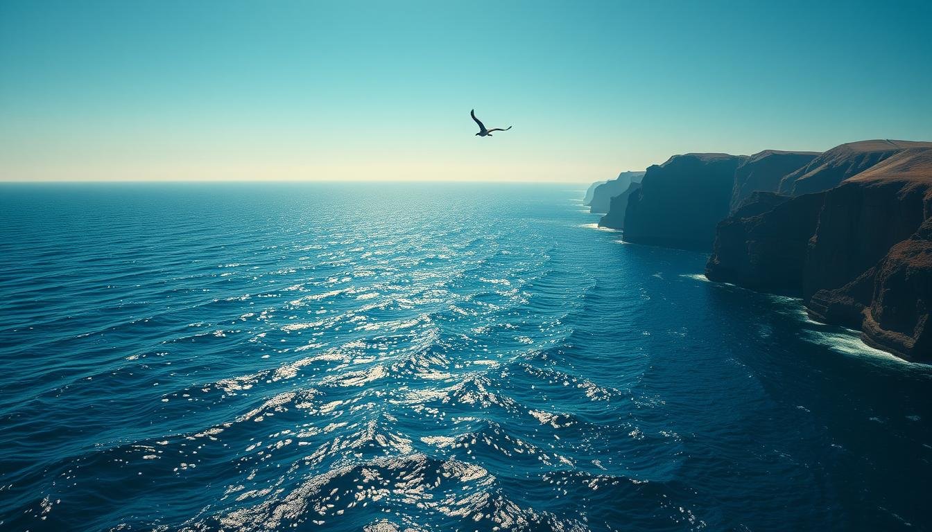
Let me hit you with a truth bomb: this ain’t your average bathtub. The Pacific Ocean covers 28% of Earth’s surface—enough to swallow every continent twice and still have room for your leftover fries. Want to know why it’s called “peaceful”? Blame Ferdinand Magellan, who named it mar pacifico in 1521 after sailing through a rare calm patch. Spoiler: he clearly missed the typhoon season.
Stretching from California’s surf beaches to Japan’s volcanic islands, this watery giant connects five continents. Imagine a middle schooler’s backpack: messy, full of surprises, and way bigger than it looks. That’s the Pacific for you—home to glowing jellyfish, underwater volcanoes, and trenches deeper than Mount Everest is tall.
Think this is just for National Geographic nerds? Wrong. Your next school project could use these wild ocean facts. Picture explaining to your teacher how the Mariana Trench could fit 36,000 elephants stacked trunk-to-tail. Mic drop.
Oh, and that “peaceful” name? Total marketing fluff. The Pacific’s got more drama than a TikTok comments section—tsunamis, rogue waves, and creatures that glow in the dark. But hey, that’s why we’re here. Let’s dive deeper than a submarine with a caffeine addiction.
Unpacking the Pacific Ocean’s Stretch: Geography and Scale
Ever tried folding a world map? Good luck tucking in the Pacific’s edges. This liquid giant hugs five continents—from Alaska’s icy shores to Australia’s coral playgrounds. Want proof? Five U.S. states dip their toes here: Hawaii surfs solo while California, Oregon, Washington, and Alaska share the mainland coast.
Bordering Continents and Nations
Picture Earth’s ultimate group chat: Asia texts volcanic islands like Japan, Australia sends koala selfies from the Great Barrier Reef, and the Americas flex their coastline muscles. Over 50 countries border this watery beast—including Chile’s jagged cliffs and Papua New Guinea’s jungle-meets-surf vibes.
Mapping Locations and Island Clusters
The Equator slices the Pacific into North and South zones like a cosmic laser. North? Think Hawaii’s pineapples and Tokyo’s sushi boats. South? Fiji’s palm trees and Polynesia’s dance-ready atolls. Zoom into any digital map—those tiny dots between continents aren’t glitches. They’re island chains hiding more secrets than your sibling’s diary.
Pro tip: Memorize these geography facts for your next trivia night. Teachers love when you explain how Polynesia’s islands could stretch from NYC to London—if they weren’t busy being paradise.
Pacific Ocean Facts for Kids: Depth and Discovery
Beneath the surface lies a world so deep, it makes the Grand Canyon look like a puddle. The Pacific Ocean isn’t just wide—it’s stupid deep, averaging 12,467 feet (3,800 meters). That’s like stacking 13 Empire State Buildings end-to-end. But the real mic drop? The Mariana Trench, a scar in Earth’s crust deeper than Everest is tall.
Imagine a crack so deep, it could swallow Mount Everest with 7,000 feet to spare. That’s Challenger Deep—the trench’s deepest point at 36,070 feet (10,994 meters). Only three crews have touched its muddy floor since 1960. Fun fact: The pressure here crushes submarines like soda cans. Yet somehow, ghostly shrimp thrive in this abyss.
What’s Hiding in the Average Depths?
While trenches hog the spotlight, most of the Pacific’s floor looks like an alien desert. Underwater volcanoes taller than Alps. Canyons wider than Texas. Hydrothermal vents spewing 750°F water. Scientists estimate we’ve mapped less than 20% of these landscapes. Your future self could discover a new species down there—no scuba gear required.
Depth Feature
Measurement
Comparison
Average Depth
12,467 ft
2.3x Grand Canyon
Mariana Trench
36,070 ft
1.3x Everest Height
Human Dive Record
1,090 ft
1/33 of Challenger Deep
Here’s the kicker: These trenches form where plates collide. One slab of Earth’s crust dives beneath another, grinding rock into magma. It’s like a slow-motion car crash—except it creates earthquakes and tsunamis. Mind-blowing? Absolutely. But that’s why we keep exploring.
Explosive Realities: Volcanoes, Earthquakes, and the Ring of Fire
Earth’s crust is throwing a non-stop rock concert along the Pacific’s edges—and the headliners are lava-spewing, mountain-building volcanoes. Three out of every four volcanoes on the planet cluster here, forming a fiery necklace called the Ring of Fire. This 25,000-mile-long zone wraps around the ocean like a toddler’s crayon scribble, connecting Japan’s smoking peaks to Alaska’s ash-covered slopes.
Active Volcanoes Framing the Ocean Rim
Forget Yellowstone. The real action happens where tectonic plates play slow-motion bumper cars. When one slab dives under another, magma rises like angry soup—creating 450+ active volcanoes. Just ask Hawaii’s Kīlauea, which has erupted nonstop since 1983. Or Mount St. Helens, which blew its top in 1980 with the force of 25,000 atomic bombs. Talk about a bad hair day.
The United States isn’t just a spectator. Alaska’s Aleutian Islands host 80+ volcanoes, while California’s Mount Shasta looms like a powdered sugar-coated threat. But here’s the kicker: these eruptions built paradise. Hawaii’s black sand beaches? Volcanic glass. Japan’s hot springs? Magma-heated groundwater. Even the Ring of Fire’s tsunamis reshape coastlines faster than your Instagram feed updates.
Want proof this belt means business? The 1883 Krakatoa explosion was heard 3,000 miles away—like someone blasting bass through Earth’s speakers. And that “peaceful” ocean? It’s hiding enough geothermal drama to power a million sci-fi movies.
Living Blueprints: Marine Life and Colorful Islands
Imagine a puzzle where 25,000 pieces are all islands—welcome to the Pacific Ocean’s ultimate mosaic. This liquid gallery bursts with more marine life than a sci-fi aquarium. Let’s break it down: three island squads rule here—Polynesia’s dance-ready atolls, Micronesia’s tiny specks, and Melanesia’s jungles crawling with birds-of-paradise.
Island Groups: Nature’s Personality Test
Polynesia stretches from Hawaii to Easter Island like oceanic confetti. Micronesia? Think 2,000+ islands smaller than your math textbook. Melanesia packs New Guinea—Earth’s second-largest island after Greenland—plus Fiji’s firewalkers and Vanuatu’s active volcanoes. Together, they host languages and cultures older than your school’s founding date.
Island Group
Notable Features
Wild Card Fact
Polynesia
1,000+ islands
Invented surfing
Micronesia
2,000+ atolls
WWII shipwrecks
Melanesia
New Guinea biodiversity
800+ languages
Coral Cities Underwater
Australia’s Great Barrier Reef isn’t just big—it’s visible from space. This coral reef system stretches longer than Texas, housing clownfish neighborhoods and sea turtle highways. But here’s the wild part: every barrier reef started as a volcano. As mountains sank, coral skeletons built skyscrapers for angelfish and octopuses.
New Zealand’s Poor Knights Islands prove marine life thrives in cold water too. Their kelp forests sway like underwater ballerinas, hiding blue maomao fish by the thousands. Meanwhile, New Guinea’s reefs flash colors so bright, they’d make a neon sign jealous. Pro tip: Reefs cover just 1% of the ocean floor but shelter 25% of all sea life. Now that’s efficiency.
Practical Pulse: Temperature, Currents, and Human Impact
Think your local pool has wild temperature swings? The Pacific Ocean laughs in Celsius. Near the Equator, surface waters sizzle at 30°C (86°F)—hotter than a July sidewalk. Head toward Antarctica? Those same waves chill to -1.9°C (28.6°F), cold enough to flash-freeze a soda. This thermal rollercoaster drives weather patterns worldwide, from California fog to typhoons near Japan.
When Water Throws a Curveball
Currents act like Earth’s AC system. The Kuroshio Current near Asia moves 50 million swimming pools’ worth of warm water daily—enough to heat New York City for a century. Meanwhile, the California Current cools the United States West Coast, creating fog banks thicker than your math teacher’s glasses.
Compare this to the Atlantic Ocean, which swaps heat faster with the poles. Or the Arctic Ocean, where ice caps lock away cold like a freezer. But the Pacific? It’s the moody artist of the bunch—unpredictable, massive, and full of surprises.
Human fingerprints show up everywhere. Plastic confetti in the Great Pacific Garbage Patch. Coral reefs bleaching like old jeans. Even Alaska’s salmon runs face warming streams. Yet every beach cleanup or fishing regulation helps. Because here’s the kicker: this ocean doesn’t just shape our weather—it’s shaped by us too.
Sailing into the Horizon: Wrapping Up Pacific Impressions
Still think you’ve got this blue giant figured out? The Pacific holds more secrets than your school’s group chat. Its waters stretch 15 times wider than the United States—a liquid colossus connecting Chile’s cliffs to New Zealand’s kelp forests. Those “peaceful” vibes Magellan hyped? Tell that to the 450 volcanoes stirring up trouble along the Ring of Fire.
From South America’s surf to Micronesia’s WWII wrecks, this ocean’s got range. Dive into its trenches, and you’ll find mountains taller than the Alps lurking in the dark. Sail the North Pacific, and watch currents shift weather like TikTok trends. Even a single page of ocean facts could fill your science fair project with enough drama for three seasons on Netflix.
Here’s the kicker: We’ve mapped more of Mars than these waters. What’s left? A labyrinth of plates grinding, coral cities breathing, and creatures glowing like rave lights. So next time you dip your toes in, remember—you’re standing where continents collide, islands rise, and the world’s largest liquid stage never stops evolving. Now ask yourself—what’s moving beneath those waves while you’re scrolling this…